Winter storm Blair: Impact and Lessons from the 2025 Blizzard
The Arrival of a Seasonal Giant
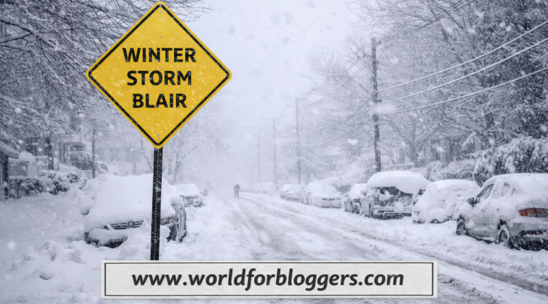
When the first week of January 2025 arrived, much of the United States was already bracing for a significant shift in the weather. Meteorologists had been tracking a massive dip in the polar vortex, a phenomenon that usually keeps the most frigid Arctic air trapped far to the north. However, as the jet stream buckled, it paved the way for a historic weather event known as winter storm blair.
This system wasn’t just another routine snowfall; it was a complex, multi-day event that combined moisture from the Gulf of Mexico with bone-chilling air from the Canadian Shield. By the time it fully developed, it stretched over 1,300 miles, affecting everything from the High Plains to the Atlantic coast. For many residents, it served as a stark reminder of the raw power of nature and the importance of infrastructure resilience.
Meteorological Origins and the Polar Vortex
The journey of this storm began in the Pacific Northwest around January 3, 2025. As the system moved inland, it underwent a process called lee cyclogenesis near the Texas-New Mexico border. This created a powerful low-pressure center that began to pull in sub-zero air from the north. Unlike smaller systems that move quickly, winter storm blair was bolstered by a “blocking high” over Greenland, which slowed its progress and allowed snow to accumulate for longer periods over the Midwest.
The primary driver behind the extreme temperatures—which dipped 15 to 25 degrees below seasonal averages—was the collapse of the polar vortex. This allowed a “lobe” of Arctic air to spill southward. When this frigid air met the moisture-rich winds from the south, it created a perfect recipe for a Category 2 “Minor” blizzard, as classified by NOAA’s Regional Snowfall Index.
Tracking the Path: From the Plains to the Mid-Atlantic
The impact of the storm followed a predictable yet devastating trajectory across the country:
- The High Plains: Kansas and Missouri were among the hardest hit. The city of Chapman, Kansas, recorded a staggering 20.5 inches of snow.
- The Midwest: Cities like St. Louis and Indianapolis saw over a foot of snow, paralyzing local transportation and leading to widespread school closures.
- The Mid-Atlantic: As the system moved east on January 6, it transitioned into a dangerous mix of sleet and freezing rain. Virginia and West Virginia faced significant ice accretion, leading to snapped power lines and hazardous road conditions.
Throughout the duration of winter storm blair, seven states—including Kentucky, New Jersey, and Arkansas—were forced to declare states of emergency to mobilize National Guard units and utility repair crews.
Human and Economic Impact
The human cost of the storm was significant. Reports indicated at least ten fatalities linked to the weather, ranging from traffic accidents on slick interstates to exposure-related deaths. The “Richmond water outage” became a notable headline during the event, as freezing temperatures compromised local utility infrastructure, leaving thousands without reliable water.
Economically, the travel industry faced a standstill. FlightAware reported over 2,300 flight cancellations on the storm’s peak day alone. Major carriers like United and Delta were forced to issue widespread travel waivers as airports from Chicago to Washington D.C. struggled to clear runways. For the average citizen, the cost was felt in power outages; at the height of the freeze, over 350,000 homes were left in the dark, testing the limits of emergency heating plans.
The Role of Ice and Freezing Rain
While the snow totals were impressive, many experts argue that the ice was the most dangerous element of winter storm blair. In parts of Virginia, ice accretion reached nearly 0.8 inches.
“A few inches of snow is a nuisance, but half an inch of ice is a disaster.”
This sentiment rang true as the weight of the ice brought down century-old trees and high-voltage power lines. The “wintry mix” caused a phenomenon known as “galloping lines,” where wind and ice cause power lines to oscillate violently until they snap. This necessitated a massive recovery effort, with utility workers from neighboring states traveling through the snow to help restore power.
Lessons in Preparedness and Resilience
Every major weather event provides a learning opportunity, and this storm was no different. It highlighted the “albedo effect,” where the fresh white snow reflected sunlight back into space, preventing the ground from warming up and keeping temperatures depressed for nearly two weeks after the clouds cleared.
Local governments have since looked at the 2025 event to improve salt-spreading logistics and grid fortification. For individuals, the event reinforced the need for:
- Alternative Heating: Having non-electric heat sources or generators.
- Communication: Relying on battery-powered weather radios when cellular networks are strained.
- Supplies: Maintaining a “72-hour kit” that includes food that doesn’t require cooking.
Looking Back at Winter Storm Blair
As we look back at the meteorological records, winter storm blair stands out not just for its snow totals, but for its reach. It was an event that affected nearly 250 million people in some capacity. It bridged the gap between a standard winter and a historic Arctic outbreak.
The storm officially dissipated over the Atlantic by January 9, but its “wake” left behind a deep freeze that lasted through mid-month. It served as a definitive marker for the winter of 2024-2025, proving that even in an era of changing climates, the Arctic still holds the power to bring the nation to a halt.
Conclusion
Ultimately, winter storm blair was more than just a forecast; it was a test of national endurance. From the farmers in Kansas digging out their livestock to the commuters in Philadelphia navigating icy sidewalks, the storm demanded a collective response. While the snow has long since melted, the data gathered during those few days in January continues to help meteorologists refine their models, ensuring that the next time the polar vortex decides to visit the lower 48, we will be even better prepared.
The legacy of winter storm blair remains a testament to the importance of early warning systems and the tireless work of emergency responders who braved the whiteout conditions to keep the public safe.
Read also our recently blog: Mexican Cheese